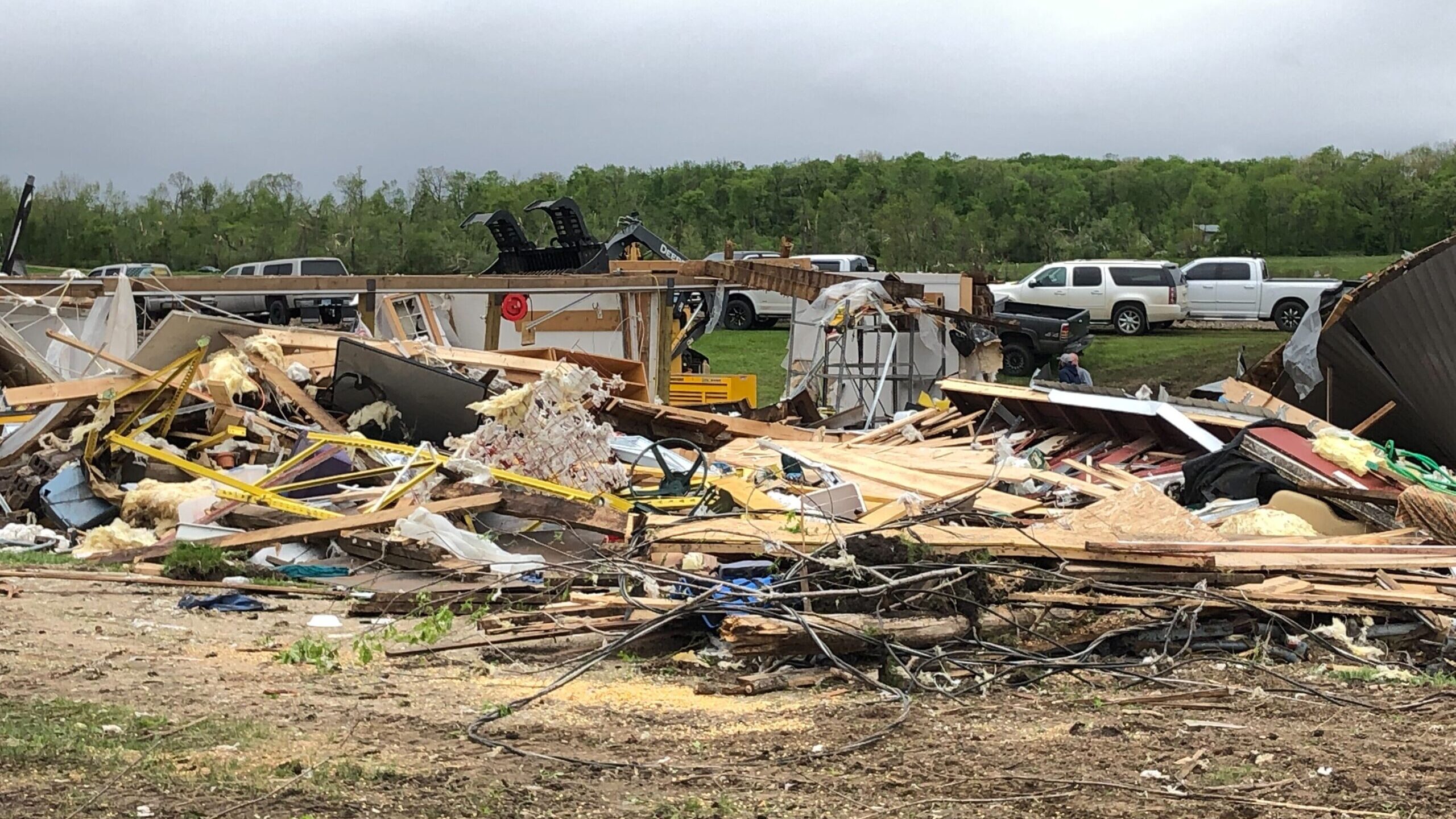
TORNADO UPDATES: Evaluation of damage in Minn. continues

(KSTP/Eric Chaloux)
The National Weather Service (NWS) is continuing its evaluation of damage caused by tornadoes, releasing preliminary information as it is gathered this week.
The NWS has released information about the paths of the tornadoes after storms caused extensive damage throughout Minnesota on Sunday.
Here’s a look at preliminary information about confirmed tornadoes and storm damage, by the NWS office:
NWS Twin Cities
This NWS office released the following reports:
An EF-2 tornado, with maximum winds of 120 mph, touched down in Forada. The tornado continued to the northeast, across Douglas County.
An EF-1 tornado, with maximum winds of 95 mph, touched down in Eagle Bend and continued northeast across Todd County.
An EF-1 tornado with winds of up to 90 mph touched down in Plato and moved across McLeod and Carver counties.
A track of EF-0 and EF-1 tornado damage was reported across four counties, between Appleton and Glenwood.
NWS Duluth
This NWS office tracked the following:
A confirmed EF-1 tornado was reported in Poplar Township in Cass County.
Another confirmed EF-1 tornado touched down in Deer River in Itasca County.
A third EF-1 tornado touched down near Hinckley.
NWS Sioux Falls
This NWS office covers the southwest corner of Minnesota as well and determined that an EF-0 tornado touched down near Adrian early Sunday morning.
Check back for updates as the NWS continues its evaluation of storm damage.
Read more about tornadoes from KSTP’s severe weather guide via the dropdown below.
WATCH VS. WARNING
A tornado watch is issued when atmospheric conditions are favorable for the development of a tornado over a large area for the next six to 12 hours. During a tornado watch, people should closely monitor updated weather statements and be prepared to move to shelter if a tornado develops in their area. Tornadoes do not always occur during a tornado watch and tornado watches can be canceled if the threat of a tornado decreases, usually due to cooler air moving into the area.
A tornado warning means a tornado has been spotted by trained storm spotters or National Weather Service radar is indicating rotation in a thunderstorm that could produce a tornado. Issuing a tornado warning based on rotation in the thunderstorm can give the public a few minutes and up to 20 minutes before a tornado hits. Tornado warnings usually cover a small area for 30 to 90 minutes and can be canceled or extended.
Many people are confused by civil defense sirens during a tornado. The civil defense sirens sounding during a tornado is to alert people outside of the storm danger and people should not depend on hearing the civil defense sirens while inside. People should get tornado warnings from NOAA weather radios, TV media or off computers and smartphones.
HOW TO PREPARE AT HOME
The safest place during a tornado is the lowest level of a home or building away from windows. Windows should be left closed to avoid allowing lightning to enter the home, as lightning is common during a tornado.
If your home is struck by a tornado, it is important to contact your home owners insurance company immediately and avoid hiring anyone to remove trees, fix damage, etc. until you speak with your insurance agent. Typically, people place tarps over homes damaged by tornadoes.
HOW TO PREPARE IF OUTSIDE OR AWAY FROM HOME
Always stay away from tornado damage, as broken glass or other sharp objects, along with adjusting building materials and trees, could cause serious injury.
Everyone should have a tornado kit that has a flashlight with extra batteries, bottles of water, foods that will not spoil, phone chargers, important documents and credit cards, food and water for pets, pillows and blankets. In the past, candles were recommended but due to the potential of leaking gas after a tornado, this is not advised.
Travel should always be avoided during an active tornado warning and being in a vehicle is extremely dangerous, because the vehicle is not anchored to the ground and is likely to roll in tornado winds.
