Hundreds of crashes, spinouts reported amid winter storm; Minneapolis, St. Paul issue snow emergencies
[anvplayer video=”5154040″ station=”998122″]
UPDATE 3:30 p.m. – Minneapolis and St. Paul have issued snow emergencies as snowfall continues across much of the area.
The two cities are just the latest to join a quickly growing list of cities with a snow emergency. Click here to see the most updated list.
Road conditions continue to worsen, too, with traffic slowed in many areas of the Twin Cities metro. Click here for an interactive map of road conditions.
From 6 a.m. to 10:30 a.m. Wednesday, the Minnesota State Patrol said it responded to 61 crashes, four of which resulted in injuries, as well as 39 vehicles spun out or off the road and one jackknifed semi. Between 10:30 a.m. and 4:30 p.m., another 141 crashes were reported, 12 of which had injuries, plus another 150 vehicles spun out or off the road.
Those numbers are sure to continue increasing over the coming hours and days.
Blizzard and Winter Storm Warnings have been issued for multiple counties across the region, as well as Wind Chill Warnings. You can find a full list of watches, warnings and advisories by CLICKING HERE.
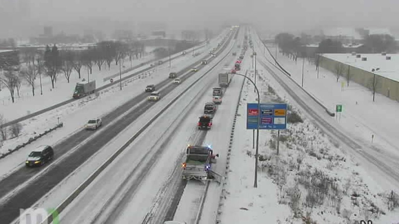
This picture from a traffic management camera at Hwy 52 northbound at Plato Boulevard shows snowy road conditions and slowed traffic on Wednesday afternoon. (Minnesota Department of Transportation)
The latest forecast can be found by CLICKING HERE, or by watching the video above. Interactive radar can be found by CLICKING HERE.
More than 100 school districts modified hours Wednesday, with many deciding to close early, and some deciding to also close Thursday. That list will likely continue to grow. CLICK HERE to find a continuously updated list of closings.
[anvplayer video=”5153975″ station=”998122″]
UPDATE 11:30 a.m. – Snow has moved into the Twin Cities metro area and is now moving into Wisconsin as a winter storm moves through the region ahead of the Christmas holiday weekend.
Road conditions have made some areas challenging to get through, and travel problems have extended to the airport, as a large portion of the Midwest will be affected by the storm.
Many people at Minneapolis-St. Paul International Airport (MSP) told 5 EYEWITNESS NEWS they rebooked their flight for Wednesday morning to try and get to their destination in time for the holidays.
Travel issues could persist all the way through Saturday. CLICK HERE for an interactive road conditions map, and HERE for a list of cities with snow emergencies.
Jeff Lea, a spokesperson for MSP, says Thursday and Friday were previously expected to be the busiest travel days before Christmas, and anticipated 33,000 people would fly out of MSP. However, he said that could change with the rush to get out of town currently underway, but added it was too soon to provide any exact numbers.
So far, dozens of airlines have issued travel waivers in anticipation for the storm, including American Airlines, United, Delta, Spirit, Sun Country and Jet Blue.
Many travelers took advantage to make it out in time, making for a crazy morning at MSP.
“Crazy… this reminded me of the Atlanta airport where the TSA is all the way backed up,” said one traveler.
“I was actually supposed to fly out at 3:49 today and when I saw the storm coming, I rearranged my flight,” said another traveler.
As of 12:39 p.m., MSP reported on its website a total of eight cancellations and 25 delays for the day.
More than 100 school districts modified hours Wednesday, with many deciding to close early, and some deciding to also close Thursday. CLICK HERE to find a continuously updated list of closings.
Meanwhile, Blizzard and Winter Storm Warnings have been issued for multiple counties across the region, as well as Wind Chill Warnings. You can find a full list of watches, warnings and advisories by CLICKING HERE.
The latest forecast can be found by CLICKING HERE, or by watching the video above. An interactive radar can be found by CLICKING HERE.
An earlier version of this report can be found below, as well as video from KSTP’s midday newscast.
[anvplayer video=”5153972″ station=”998122″]
[anvplayer video=”5153922″ station=”998122″]
INITIAL REPORT: Schools, airlines, traffic agencies and holiday travelers are preparing for wintry conditions ahead of the storm that’s expected to begin Wednesday.
5 EYEWITNESS NEWS Chief Meteorologist Ken Barlow says the precipitation is coming just in time for the official start of winter at 3:48 p.m. Wednesday.
Barlow explains snow will develop around 8 a.m. Wednesday in the metro and then get heavier throughout the day before eventually tapering off after midnight. The Twin Cities metro area is expected to get between 5-8 inches of snow, with at least half of that falling by Wednesday evening.
That snow will start blowing around midday Thursday as wind chills drop into the negative-35-to-negative-40 degrees range.
Stay with Minnesota’s Weather Authority online and on air for the latest updates.
RELATED: Winter storm brings brutal cold, treacherous travel conditions ahead of holiday weekend
Winter storm warnings and wind chill watches for Minnesota counties are in effect starting Wednesday morning and running overnight into Thursday. Additionally, some counties have proactive winter storm watches as meteorologists monitor conditions Thursday and beyond.
Thursday, snow is expected to continue moving through Wisconsin, where counties have also issued proactive winter storm watches and warnings.
CLICK HERE TO VIEW A FULL LIST OF CURRENT WEATHER ALERTS IN MINN. AND WIS.
Many schools have already made scheduling decisions to get ahead of the storm. CLICK HERE to see if your school district has issued an alert.
Additionally, many airlines have issued travel waivers for people to change flights as early as possible if they anticipate disruptions to their holiday trip plans.
“If you feel like there’s an opportunity to say leave [Tuesday] or early [Wednesday] rather than certainly late Wednesday or anytime Thursday, by the looks of it you should probably do it,” said Kyle Potter, the executive editor of Minnesota-based travel website Thrifty Traveler.
Potter added, “This could be the difference between making it somewhere for the holidays and not making it anywhere at all,” he said. “It’s going to test the entire airline industry.”
RELATED: MSP prepares for disruptions during travel surge before Christmas
For those driving, the Minnesota Department of Transportation (MnDOT) tells people to keep emergency kits in cars when traveling this holiday weekend.
Additional MnDOT tips are as follows:
- Watch for snowplows, which can turn or exit quickly and frequently, and stay at least 10 car lengths away
- Slow down and keep cruise control off
- Be patient and alert as you drive
- Wear seatbelts
- Monitor visibility, and don’t drive in a snow cloud
- Turn headlights on
If you’re driving, make sure to bundle up then check road conditions with KSTP traffic and Minnesota’s Weather Authority before you go.