Winter storm brings brutal cold, treacherous travel conditions ahead of holiday weekend
[anvplayer video=”5153892″ station=”998122″]
A major winter storm will impact the middle of the country during some of the busiest travel days of the year. The team of meteorologists at Minnesota’s Weather Authority is ready to keep you prepared as we get closer to Christmas.
Winter Storm Warnings are in effect across most of Minnesota and Wisconsin Wednesday and Thursday. This does include the Twin Cities metro. Farther north, Winter Weather Advisories are in effect from Detroit Lakes through the arrowhead.
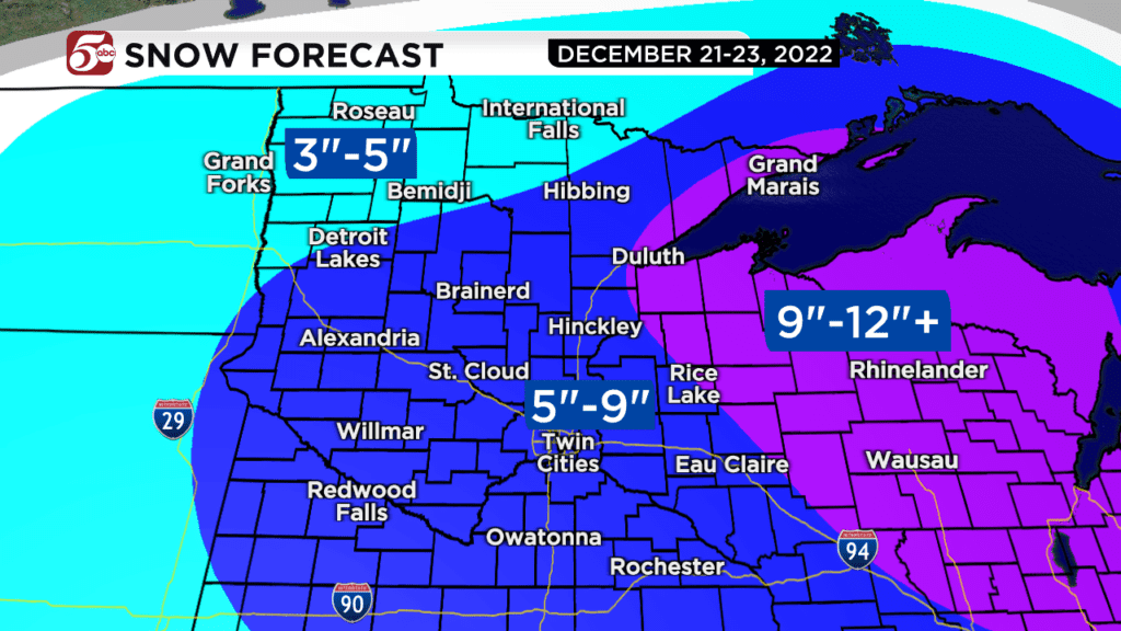
Most of Minnesota and Wisconsin should get anywhere from 5 to 9 inches of snow. The best chances of the bigger snow totals are northwest of the Twin Cities into central Minnesota. Parts of western Wisconsin could get more than 10 inches of snow through Thursday.
If you are a skilled winter driver, you will be able to get around Wednesday and Thursday morning if you drive cautiously. Plan on any trip taking much longer than normal. As the snow ends, winds pick up late Thursday, and that is when any traveling could become dangerous.
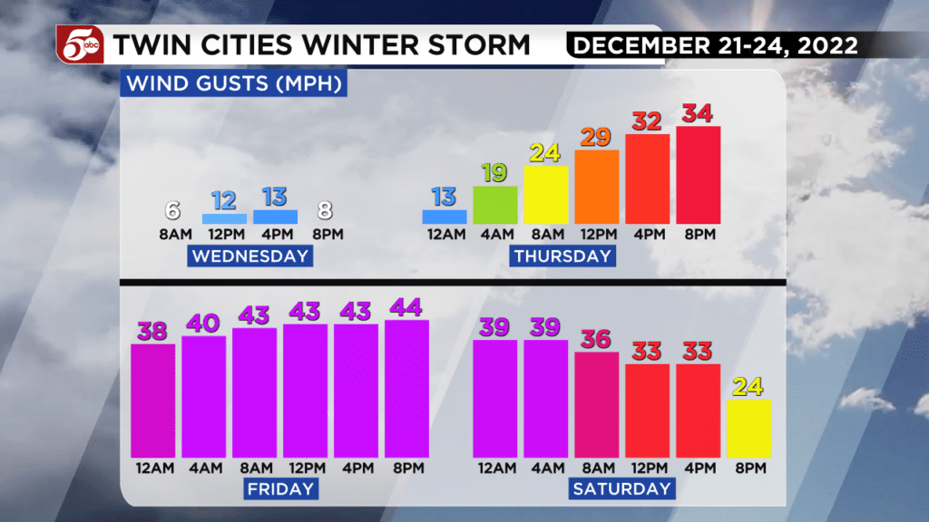
There are Blizzard Warnings already issued for parts of southwest and south-central Minnesota from Thursday evening through Saturday morning. Even if you are not officially in a Blizzard Warning, there could still be dangerous driving conditions during that time. Wind gusts up to 50 mph will blow the fluffy snow back on to roads, and cause whiteout conditions in any open areas.
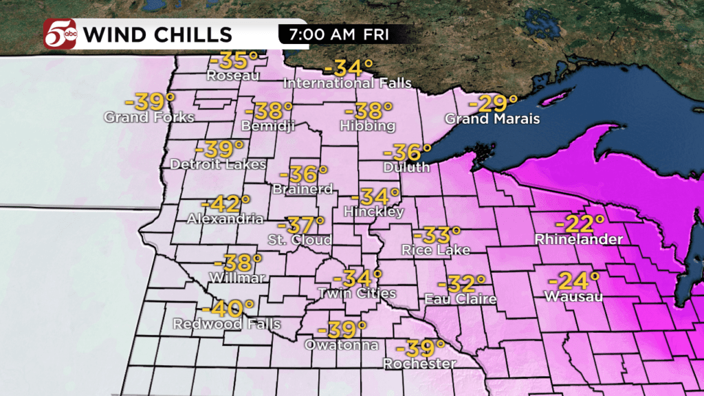
Travel is strongly discouraged from Thursday evening through Saturday morning unless it is an emergency. If you are planning on traveling, you must have a winter weather kit in the car. If you get stranded in the snow, you need to protect yourself from bitterly cold temperatures, and wind chills that could be as cold as -40° in parts of Minnesota.
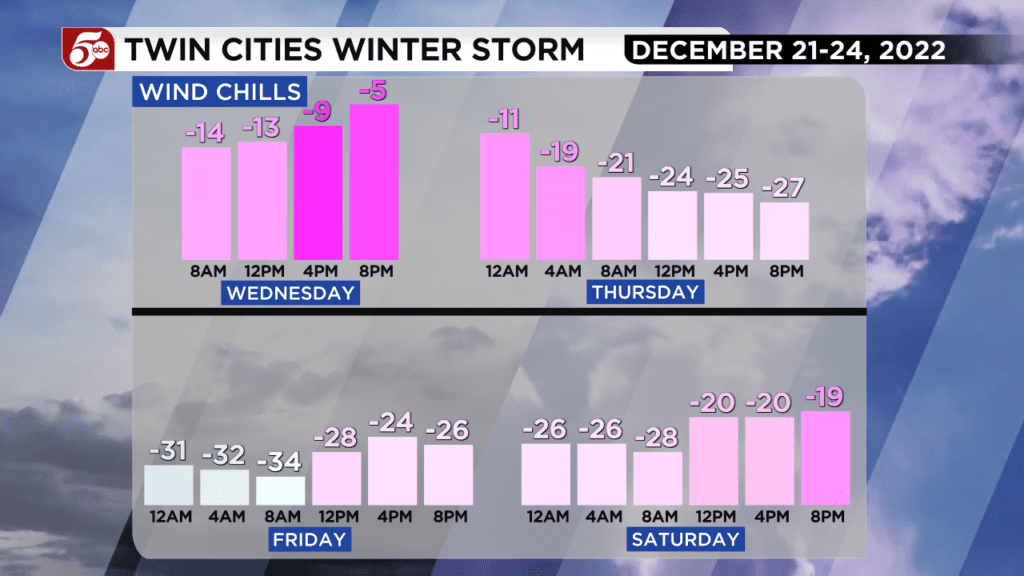
When wind chills reach -20° to -30°, frostbite and hypothermia are possible in as little as 15 minutes. As wind chills approach -40°, that time drops to 10 minutes. This is why the combination of blizzard conditions, very cold wind chills, and a busy time for travel make this storm particularly dangerous.
Doctors say people should dress for the occasion and limit time outside, adding mittens are better than gloves because they’ll keep hands warmer. People should also dress in layers; an inner layer, a warm layer and a wind-blocking top layer are recommended.
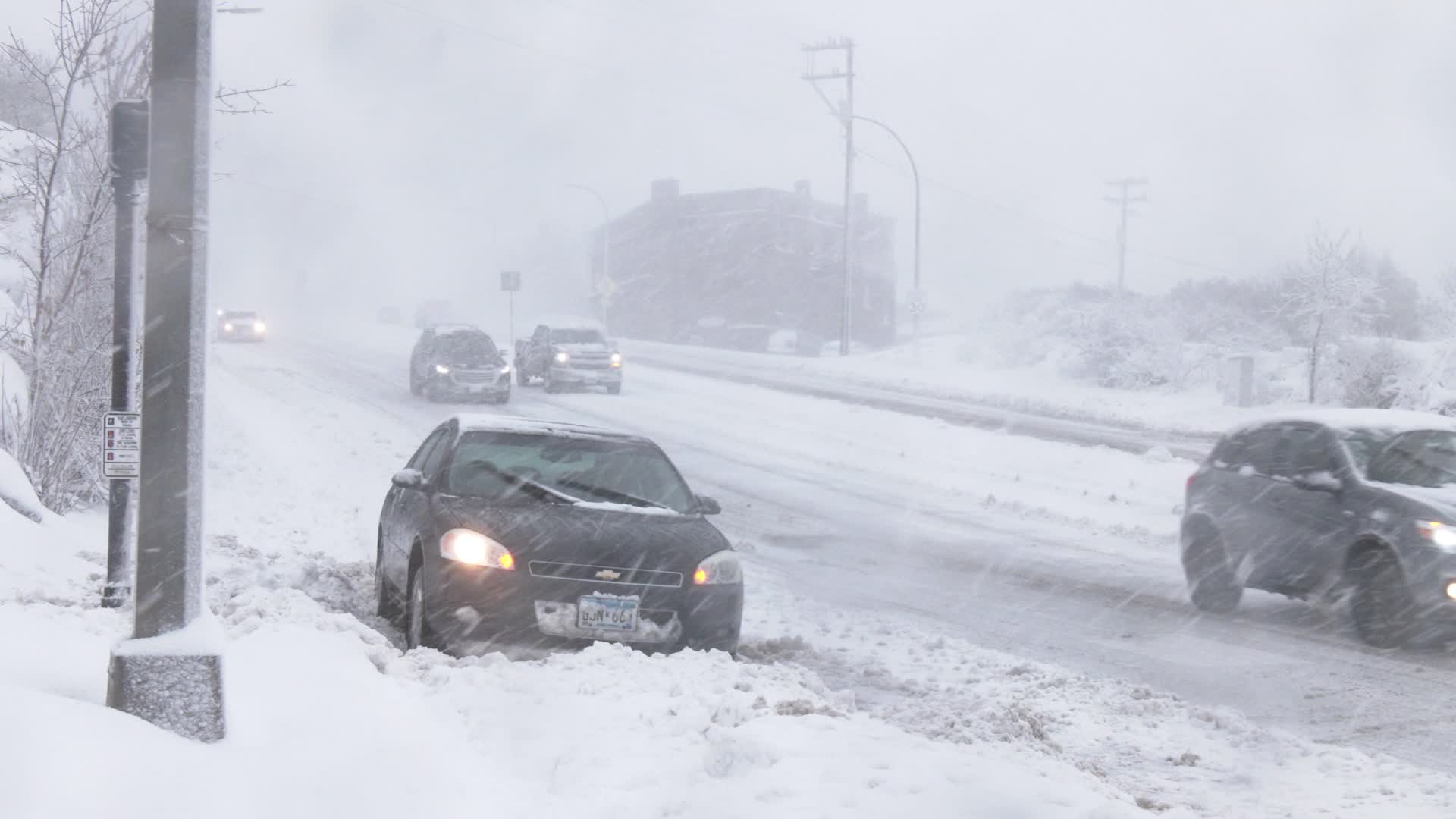
Cars travel during a snowstorm Wednesday, Dec. 14, 2022, in Duluth. (WDIO)
Anyone who experiences frostnip, a mild form of frostbite, should make sure to not rush to warm up and use lukewarm water on their hands or feet to slowly increase temperature.
In the air, long flight delays are possible leaving the Twin Cities, but also in regional hubs like Chicago and Detroit. If you have a connecting flight in Chicago Thursday afternoon through Saturday, your chances of having that flight are very low.
Warming shelters are located across the Twin Cities region. You can find additional details on those by CLICKING HERE for Hennepin County and by CLICKING HERE for Ramsey County.
Minnesota’s Weather Authority will keep you updated on air, online, and on social media through this storm.