First round of snowfall arrives in Twin Cities; busy weather week ahead
Get ready for a busy weather week.
5 EYEWITNESS NEWS Meteorologist Matt Serwe says much of Minnesota and Wisconsin, including the Twin Cities, is expected to get hit by three separate rounds of snow this week.

Serwe says each snow system will be heavier than the last, with major travel disruptions possible Wednesday and Thursday.
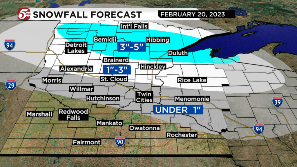
It kicked off Monday morning with some on-and-off snow showers, which could last throughout the day and will only amount to around an inch in the Twin Cities. Farther north, between 3-5 inches is possible and, thanks to temperatures in the low to mid-30s, Monday’s snowfall will be a wet, sticky snow.
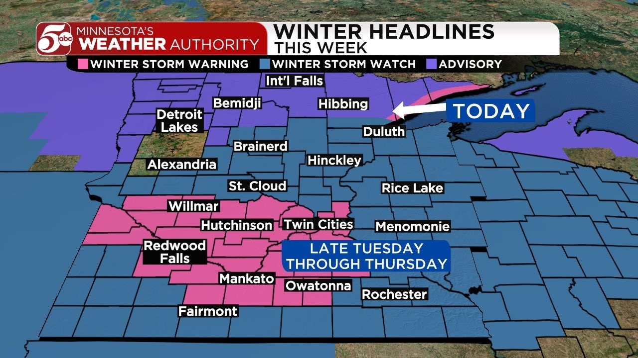
Tuesday morning brings a break before the second round starts Tuesday afternoon. Serwe says that round will bring light to steady snow from Tuesday evening through Wednesday morning in the Twin Cities, dropping another 3-6 inches of snow from the metro area to Willmar and south.
A winter storm warning is already set to take effect Tuesday for that round of snow and will remain in effect through Thursday night.

Again, another small break is possible around midday Wednesday before the third and largest round of snow arrives in the Twin Cities Wednesday afternoon or evening.
Serwe says that third round is expected quickly become heavy and will fall through the first half of Thursday before tapering to lighter snow Thursday afternoon. Because of colder weather, that snow will be fluffier and, when paired with wind gusts at more than 30 mph, will make blizzard conditions likely.
However, just from Wednesday afternoon through Thursday, that round alone may drop 10 inches of snow or more. More specific totals will become clearer as that round gets closer but Serwe says even more than 10 inches from that round is possible.
Add it all up and the Twin Cities could easily get more than 12 inches of snow and possibly closer to two feet by the end of Thursday.
After the snowfall ends, temperatures will drop below zero Friday morning before sunshine and high temperatures in the upper 20s return.
Stay with Minnesota’s Weather Authority throughout the week on air, online and via social media for the latest updates on as the week progresses. Click here for the latest weather forecast.
The Minnesota Department of Transportation chimed in Monday morning, urging Minnesotans to plan ahead and stay home this week if possible. Several airlines have also begun offering travel waivers.
RELATED: Airlines start issuing travel waivers with winter storm looming
Just from 8 a.m. to noon Monday, nearly 160 crashes 50 spinouts were reported by the Minnesota State Patrol.
 Winter isn’t over, Minnesota!
 Snowplow crews will be out working statewide, but this storm could be a doozy.