The latest forecast for snow Saturday night

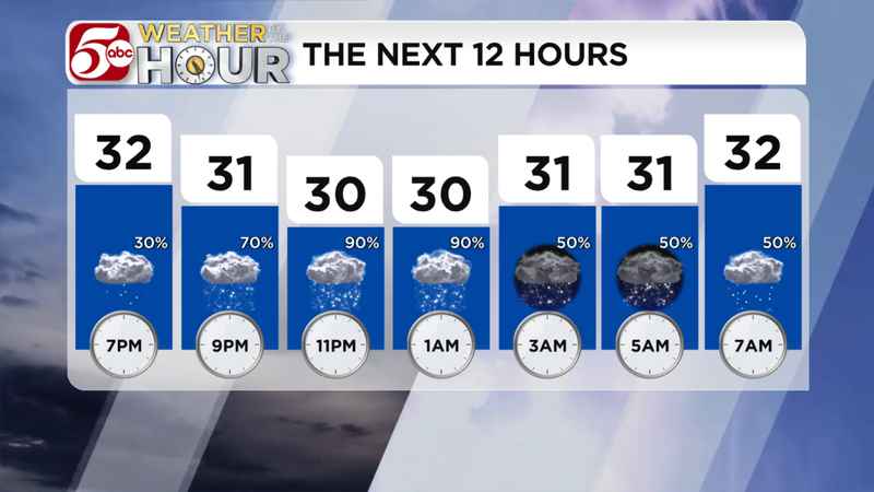
Hourly forecast for Saturday night into Sunday morning.[KSTP]
Snow is moving across Minnesota Saturday night. Most of the impacts will stay north of the Twin Cities metro.
Light snow is pushing from western Minnesota into the Twin Cities Saturday evening. Temperatures are slowly dropping below freezing, so the snow should start to stick to untreated roads. Most of the metro should get an inch or so by early Sunday morning, but the far northern metro could get up to 2 inches. Scroll down to see the full snow total map.
Farther north into central Minnesota and into northwest Wisconsin, Winter Weather Advisories are in effect. Snow will continue in these areas through most of Sunday morning. This is also where snow totals could change a lot over a short distance. In the Advisory counties, 3 to 6 inches of snow are possible.
In northern Minnesota and extreme northwest Wisconsin, Winter Storm Warnings are in effect through Sunday. Light to steady snow will continue in these areas through all of Sunday, pushing snow totals higher. In the Warning counties, 6 to 10 inches of snow are possible, with some local amounts approaching 12 inches. The western shores of Lake Superior could get some lake enhancement, sending some totals up to 16 inches.
After the snow on Sunday, a shot of intense cold and strong winds are likely Sunday night into Monday morning. While a few snow showers are possible, the biggest impact will be from the wind and cold. Northwest winds could gust up to 50 mph Sunday night, pushing wind chills from -5° ro -15° through all of Monday.
Stay with us at kstp.com as winter weather arrives in Minnesota. You can always get your latest forecast here.