Severe weather possible across Minn. Friday night
Another round of severe storms is likely across parts of Minnesota Friday night into early Saturday morning.
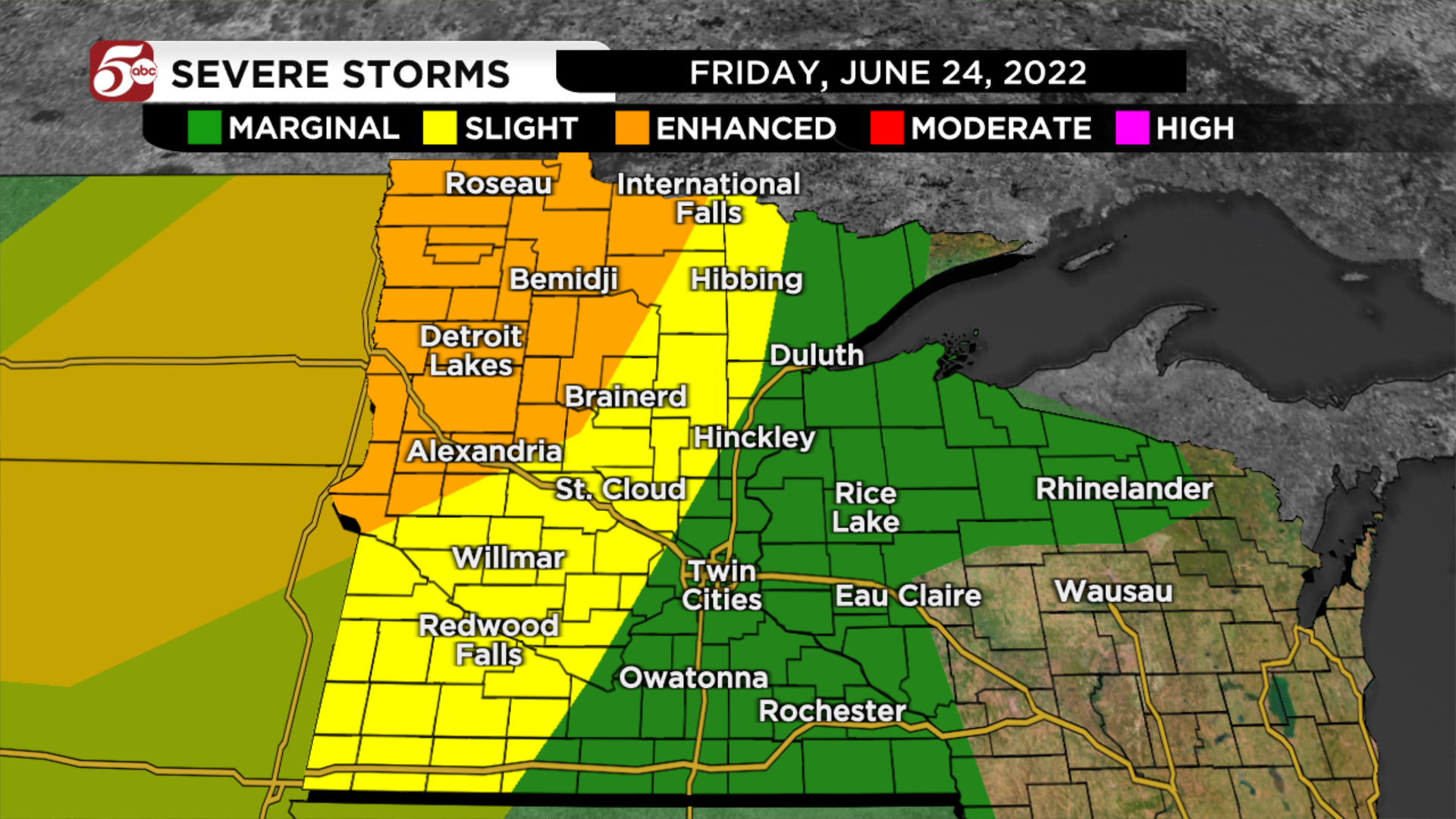
The highest chances of seeing dangerous are in northwest Minnesota. That is where the Storm Prediction Center has an enhanced risk for severe storms. The potential for severe storms gets a little lower in central Minnesota (slight risk) through the Twin Cities metro (marginal risk).
Storms should develop near or after 7:00 PM around the Minnesota-North Dakota border. These initial storms could have some very large hail, damaging winds, and isolated tornadoes. As the storms move east after sunset, they should form into a bigger line, and damaging winds will be the main impact.
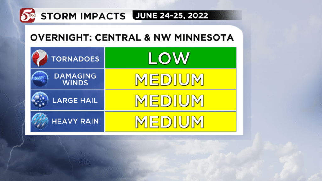
After midnight, that line of storms will be moving across central Minnesota. Another batch of storms should develop across southern and southwestern Minnesota. This second area of storms could have damaging winds and hail, but also produce more locally heavy rain. These would continue through sunrise in the Twin Cities metro.
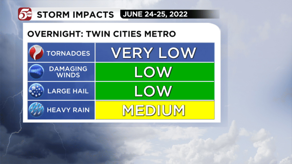
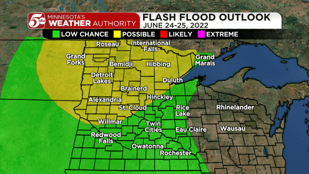
While hail and strong winds are possible, the bigger impacts could come from locally heavy rain. Parts of central Minnesota picked up 3-6″ of rain Thursday evening through early Friday.
RELATED: MnDOT: 12″ of rain reported in Randall, portion of Hwy 10 remains temporarily closed
Any additional heavy rainfall in those cities could quickly lead to flash flooding. That is especially dangerous at night when it is dark – as a reminder, never drive across water-covered roads! CLICK HERE for an interactive radar.
Storms could linger through the first half of Saturday. While these would probably not be severe, they could keep lighting and some downpours across the Twin Cities metro. The rest of the weekend will be drier and much cooler – you can find your latest forecast by CLICKING HERE.
A guide to severe weather coverage can be found by FOLLOWING THIS LINK, and photos of severe weather can be submitted by CLICKING HERE.