Water levels at Great Salt Lake drop to historic low

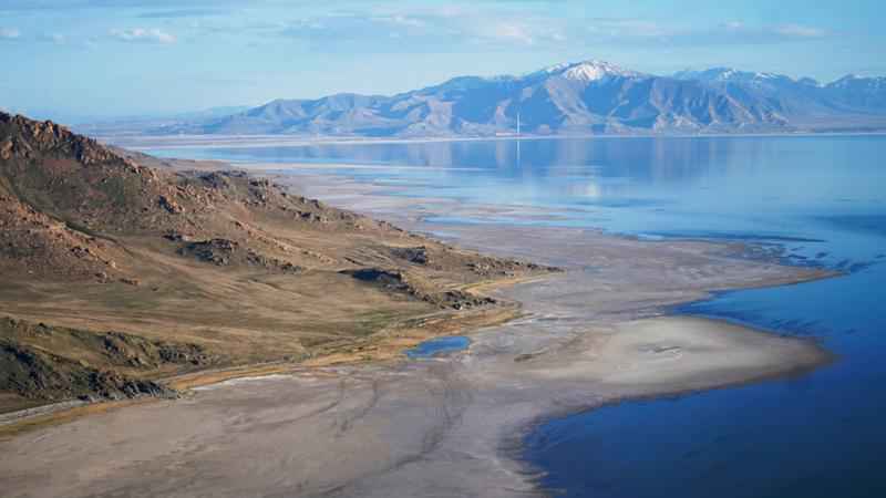
The Great Salt Lake recedes from Anthelope Island on May 4, 2021, near Salt Lake City. The water levels at the Great Salt Lake have hit a historic low, a grim milestone for the largest natural lake west of the Mississippi River that comes as a megadrought grips the region. [AP Photo/Rick Bowmer]
The water levels at the Great Salt Lake have hit a historic low, a grim milestone for the largest natural lake west of the Mississippi River that comes as a megadrought grips the region.
On Saturday, the U.S. Geological Survey announced average daily water levels had dropped about an inch below the previous record of 4,191.4 feet (1,278 meters), which was set in 1963.
The new record comes months earlier than when the lake typically hits its lowest level of the year, indicating water levels could continue to drop even further, said Candice Hasenyager, the deputy director of Utah’s Division of Water Resources.
Receding water s are already affecting a nesting spot for pelicans, which are among the millions of birds dependent on the lake. Sailboats have been hoisted out of the water to keep them from getting stuck in the mud. More dry lakebed getting exposed could send arsenic-laced dust into the air that millions breathe.
People for years have been diverting water from rivers that flow into the lake to water crops and supply homes. Because the lake is shallow — about 35 feet (11 meters) at its deepest point — less water quickly translates to receding shorelines.
Most years, the Great Salt Lake gains up to 2 feet (half a meter) from spring runoff. This year, it was just 6 inches (15 centimeters).
The drought is drying up lakes across the West and worsening massive wildfires affecting California and Oregon. Utah Gov. Spencer Cox, a Republican, has begged people to cut back on lawn watering and "pray for rain."
Extreme conditions like these are often from a combination of unusual random, short-term and natural weather patterns heightened by long-term, human-caused climate change.
Scientists have long warned that the weather will get wilder as the world warms, and climate change has made the West much warmer and drier in the past 30 years.