Winter weather advisories, warnings take effect late Wednesday, continue into Thursday evening
A winter weather advisory will begin at 9 p.m. Wednesday night and will remain in effect until at least 6 p.m. Thursday, according to current weather alerts.
Most of Wednesday will be mostly cloudy and quiet, but below freezing temperatures will freeze the slush that has accumulated on streets and sidewalks.
Steady to heavy snowfall is expected to begin around 8 p.m. Wednesday and will continue throughout the night and into Thursday.
CLICK HERE for an interactive radar.
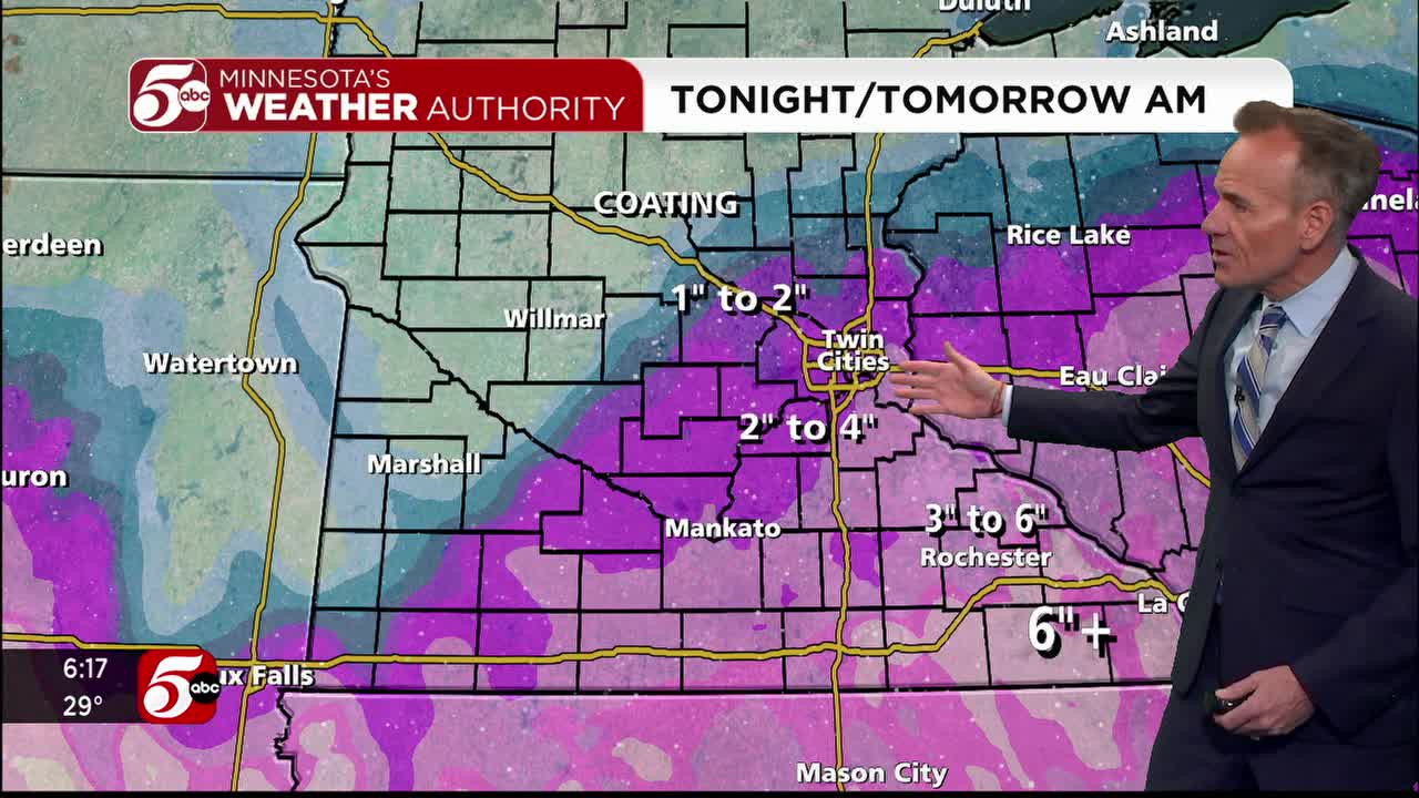
About 2-4″ is expected in the Twin Cities, but the anticipated storm will likely bring lighter snow in the north with heavier snow in the south. Totals of about 5-6″ totals are possible in Scott, Dakota, and southern Washington County. Farther south, 6-9″ of snow is possible south of Owatonna and along the I-90 corridor. This is expected to create hazardous road conditions.
KSTP morning weather forecast for Jan. 18, 2023.
MnDOT warned that travel conditions will be difficult in Southeast Minnesota as snowfall begins Wednesday night. A news release from MnDOT states that drivers should check road conditions Thursday and prepare for a challenging commute that morning. The National Weather Service issued a winter storm warning to make people aware of the impacts.
Areas of western Wisconsin could also see anywhere from 5-8″ of snowfall, since a Winter Storm Warning is in effect for Dunn, Eau Claire, Pepin and Pierce counties starting at 9 p.m. Wednesday.
RELATED: Tips to prepare for winter weather
Traffic reporter Hanna Conway will have the latest updates. You can follow her on Twitter by CLICKING HERE.
CLICK HERE for the latest forecast.
Weather photos and videos can also be shared with 5 EYEWITNESS NEWS by CLICKING HERE.