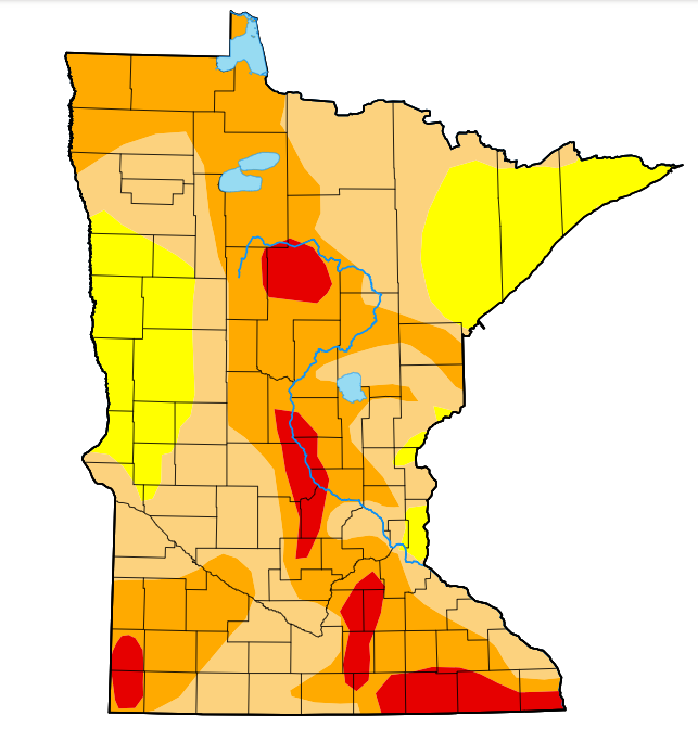
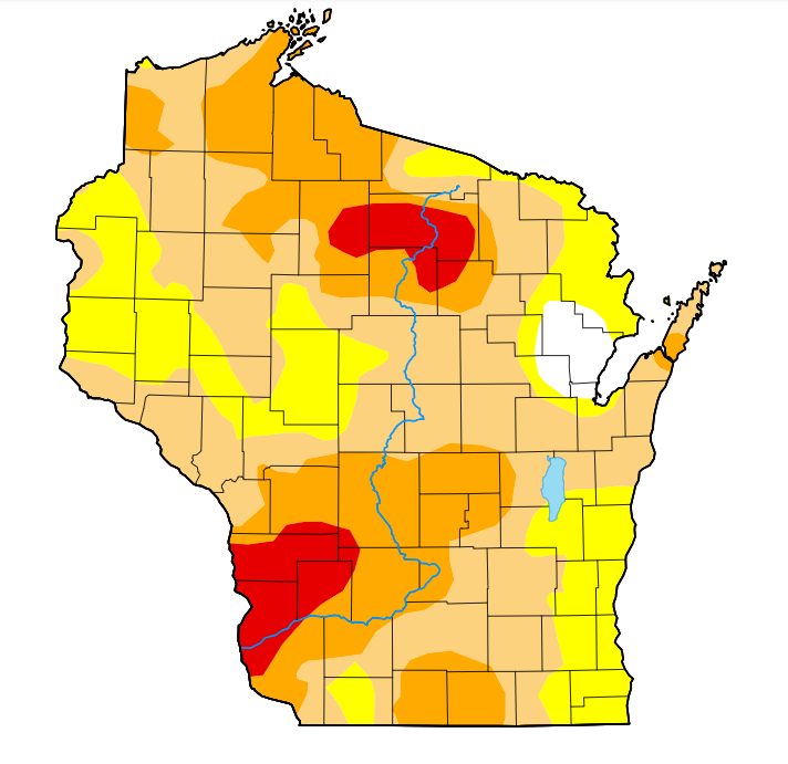
Drought levels remain relatively the same in Minnesota, Wisconsin
The latest data from the United States Drought Monitor shows while dry conditions persisted this week, the drought hasn’t worsened across Minnesota and Wisconsin due to recent rainfall.
5 EYEWITNESS NEWS Chief Meteorologist Ken Barlow says the Twin Cities area has only seen 0.13 inches of rain since Oct. 1. That rain came after record-high temperatures were recorded on Sept. 30 and Oct. 1, with warm temperatures continuing the following two days. CLICK HERE for an interactive map showing rainfall amounts across the region from Oct. 1 through the morning of Oct. 5.
According to the information released Thursday, extreme drought levels dropped in Minnesota by less than half a percent across the state, from 8.03% to 7.6%. Moderate drought levels also dropped by roughly the same amount, from 82.65% to 82.03%. Severe drought levels decreased the most, from 46.65% to 43.61%.
In Wisconsin, data shows extreme drought levels remained exactly the same at 6.77%. Meanwhile, severe drought dropped by a little more than 4.5% across the state since last week, and moderate drought dropped by nearly 5.8%.
CLICK HERE for the latest forecast from Minnesota’s Weather Authority, which calls for more chances of rain on Friday and more seasonable temperatures. CLICK HERE for an interactive radar.