The Latest: Greenwood Fire acreage reduced to 8,862 based on infrared mapping
[U.S. Forest Service - Superior National Forest]
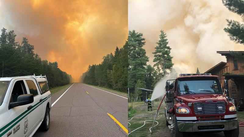
Additional crews and planes are being brought in to help fight the Greenwood fire. Acreage was reduced to 8,862 Sunday based on the infrared mapping, according to Hubbard Broadcasting sister station WDIO-TV.
Evacuations orders are in effect for McDougal Lake, Sand Lake, the Highway 2 corridor, and north of Highway 1 in the vicinity of East and West Chub lakes, Jackpot, and Slate Lake.
The evacuations began around 2:30 p.m. Friday in the area around Minnesota Highway 1 near Lake County Highway 2, on the Tomahawk Trail, and on other roads.
The U.S. Forest Service says the evacuations in the Sand Lake and Stony Lake areas were triggered when the fire crossed over Lake County Highway 2, a Management Action Point.
The Lake County Sheriff visited about 90 homes and cabins earlier this week to notify residents of the evacuation area.
The American Red Cross is operating a temporary evacuation shelter at the Finland Community Center. More information about their efforts can be found here.
Hundreds of personnel are working to suppress the flames using three aircraft and 38 fire engines. Their efforts to protect structures include brush clearing, creating defensible space, and hose laying.
The U.S. Forest Service said lightning caused the fire near Greenwood Lake, about 25 miles southwest of Isabella in the Superior National Forest.
A Forest Service closure order remains in place across areas within the Kawishiwi, Laurentian, and Tofte Ranger Districts and a small portion of the Boundary Waters Canoe Area Wilderness. This includes all lands, waters, trails, portages, canoe routes, Wilderness entry points, and recreation sites as shown on the map, exhibit A, in the closure order. Private property owners can access private property.
A temporary flight restriction for aircraft is also in effect over the fire area.
A public meeting will be held Monday, August 23rd at 6:00pm for the Greenwood Fire, Superior National Forest fires and the Boundary Waters Canoe Area Wilderness closure with presentations from the Forest Service, Sheriff, and the Incident Command Team.