Storm warnings & wintry mix moving through Minnesota; 6 dead in Iowa
[anvplayer video=”5094170″ station=”998122″]
A large dynamic spring system continues to work across the metro and much of the north-central U.S. tonight.
Just after 9 p.m., emergency managers in Madison County, Iowa, confirmed that six people had died a suspected tornado, including four adults and two children. Four others were injured.
The National Weather Service Des Moines said initial investigation indicates that an EF3 or greater tornado hit Winterset late Saturday afternoon. Teams will be out Sunday surveying damage and assessing the tornado’s rating.
As of 9:30 p.m., there were 32 tornado reports in Iowa, 28 hail reports in Michigan, Iowa and Wisconsin and 14 damaging wind reports.
In Jackson, Minnesota, 3/4-inch hail, the size of a penny, was reported. In Orientiowa, Iowa, reported 2-inch hail — the size of an egg.
As of 7:30 p.m., we have seen all types of weather!
- Rain (intense rain for this early in the season)
- Thunderstorms
- Hail
- Dense Fog
- Freezing Rain
- Sleet
- Snow
- Strong Winds
- Tornados (Iowa)
And some of these weather elements were happening simultaneously! Hail & freezing rain!
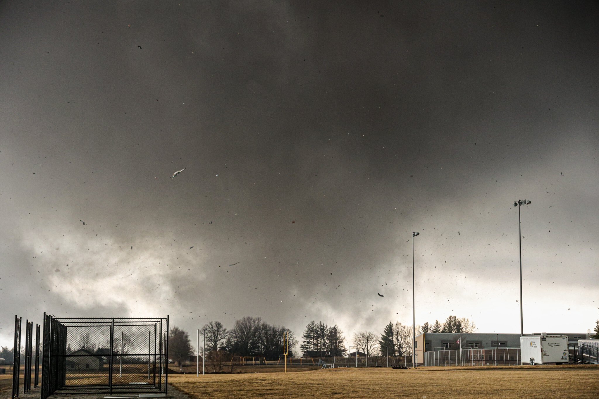
Winterset, Iowa. Photo by Chris Manning @photosbymanning
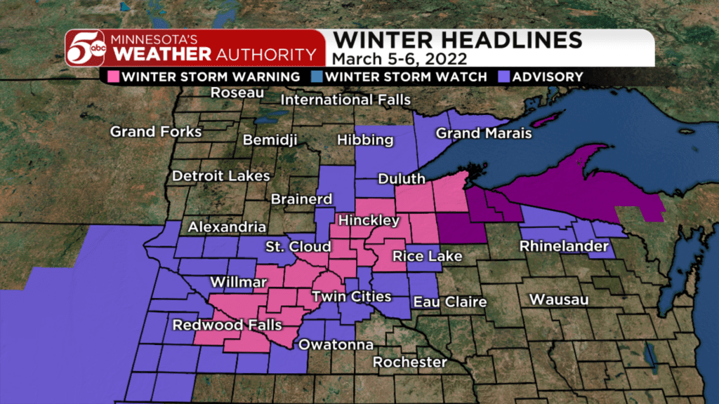
Saturday night the system will continue to move over the Great Lakes and bring sleet, freezing rain and snow across the metro. The combination of snow and ice will cause treacherous travel.
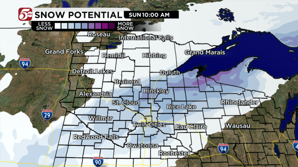
Winter storm warnings are now in effect until 4 a.m. Sunday morning when the snow is expected to wrap up. Widespread snow of 1-2” is possible, but 3” in isolated spots can’t be ruled out. This is a tricky one because there is no one size fits all forecast. It really is dependent on the type of precipitation falling, temperatures aloft and at the surface, and where the available moisture still is.
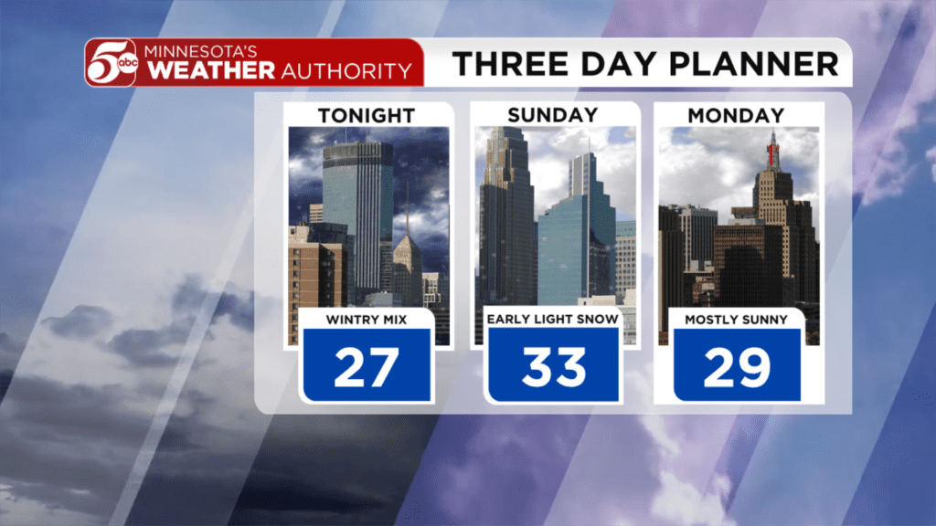
Drive safe if you are on the roads Saturday night or early Sunday morning! It will be a grab bag of weather!