Scattered severe storms possible late Sunday
[anvplayer video=”5125676″ station=”998122″]
A summer-like weekend finishes with more heat, more humidity, and the potential for stronger storms across Minnesota and western Wisconsin.
There could be a few isolated storms early Sunday in far northern and western Minnesota. These will not be severe, and they will not impact the Twin Cities.
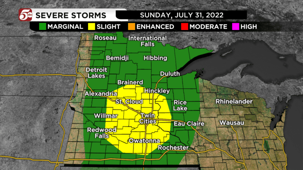
Another round of storms develops along a cold front late in the afternoon. These should start in central Minnesota after 4:00 PM, and then move east through the evening.
The best chance for storms in the Twin Cities would be 5:00 PM to 9:00 PM Sunday.
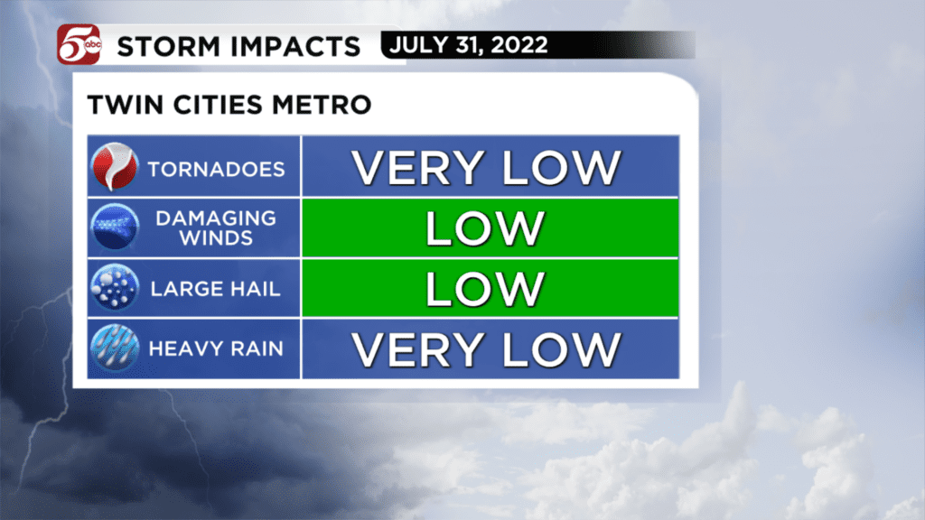
Any storm could have large hail, and as they grow into a bigger line, there could be damaging winds.
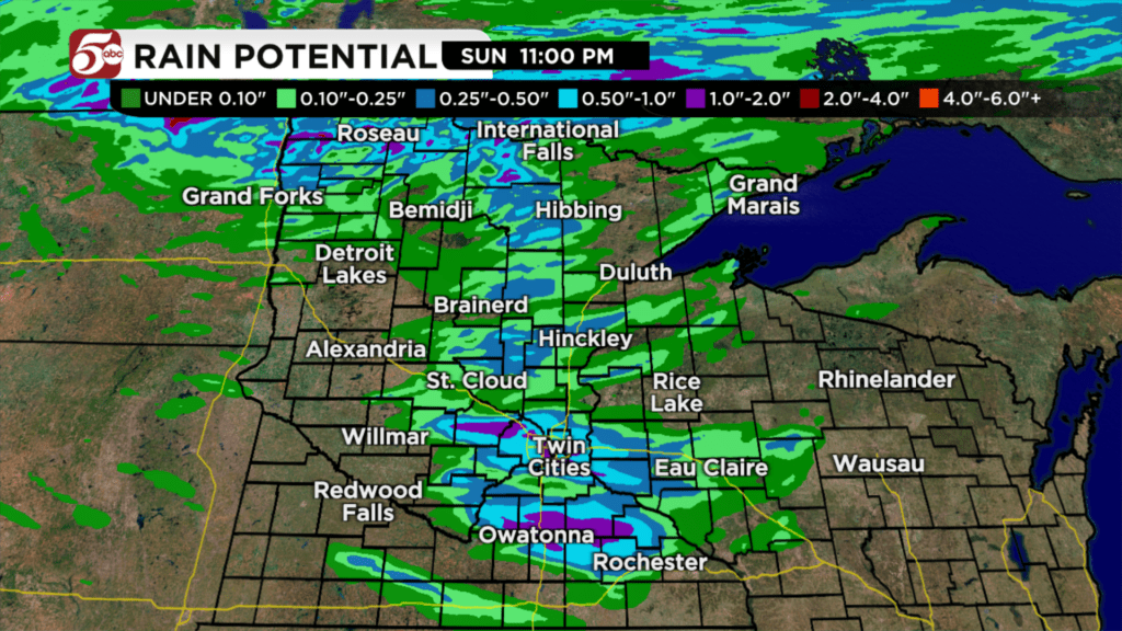
Overall, the tornado potential is very low. Heavy rain is likely in any strong storm, but since they will be moving quickly and it has been so dry, flash flooding is unlikely.
Since these storms could impact people coming back from the cabin or any other weekend travel, make sure you have a way to get severe weather information on the go.
Download the KSTP Mobile App to get severe weather alerts on your phone, plus the latest forecast from Minnesota’s Weather Authority.

The Storm Prediction Center's severe weather outlook for Sunday, July 31, 2022. Credit: Matt Serwe/KSTP
CLICK HERE for the interactive radar, and CLICK HERE for any current weather alerts.