Winter storm to bring snow, wind, ice to Midwest throughout the week
")
(Matt Serwe/KSTP)
A large winter storm is expected to bring snow, wind and ice to the upper Midwest throughout the week, and although the amount of precipitation will vary by location, more accumulating snow is likely Thursday and Friday across most of Minnesota and Wisconsin.
The National Weather Service (NWS) has issued a Winter Storm Warning across most of central and northern Minnesota for Tuesday and Wednesday. Farther south, a Winter Weather Advisory is in effect. The Twin Cities metro is in the Winter Weather Advisory.
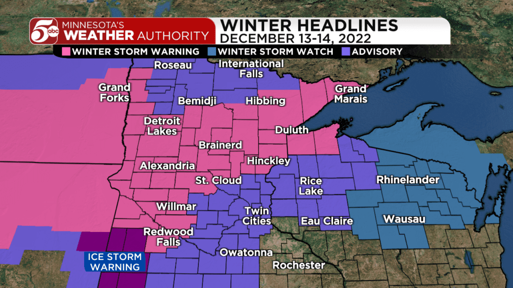
There is also an Ice Storm Warning in effect in southwest Minnesota Monday night into Tuesday morning. Up to 0.40 inches of ice is possible from Marshall to Worthington toward the South Dakota border. In addition to dangerous road conditions, wind gusts up to 40 mph could produce widespread power outages where the ice accumulates.
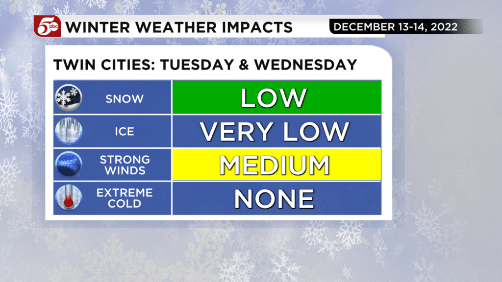
Around the Twin Cities, a rain and snow mix will likely limit the storm’s overall effects through most of Tuesday.
One of most difficult parts of this forecast, according to 5 EYEWITNESS NEWS meteorologist Matt Serwe, is where freezing rain and sleet are possible on Tuesday morning.
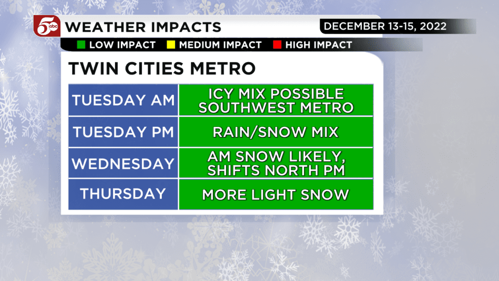
Southwest Minnesota is most likely to receive icy precipitation, and then it tapers off as it moves east toward the Twin Cities. There could be some light icing in the southwest metro early Tuesday, so make sure to check road conditions with Hanna Conway on 5 Eyewitness News Mornings.
Warmer air is expected to change the precipitation to a rain and snow mix in the Twin Cities through Tuesday afternoon. In central and western Minnesota, it will all be snow. Farther southeast toward Rochester, it will all be rain with possible thunder.
As temperatures drop Tuesday night, snow is more likely around the Twin Cities and central Minnesota. Snow will continue through Wednesday morning, then lift north of St. Cloud through the afternoon.
Isolated rain and snow showers are still possible Wednesday afternoon, but dry air will eventually move in.
Snow totals through Wednesday should only be an inch or two in the Twin Cities metro. Snow totals will vary depending on when the rain and snow mix changes to all snow.
Farther north, 3-6 inches is likely across most of central Minnesota through northwest Wisconsin. Some totals over 8 inches are possible around Duluth and the North Shore, as well as far western Minnesota.
However, the storm system won’t be done with the upper Midwest mid-week; more accumulating snow is likely Thursday and Friday across most of Minnesota and Wisconsin. This will likely add at least a few more inches through the end of the week.
Get the latest forecast from Minnesota’s Weather Authority as our meteorologists track several rounds of winter weather this week.
Find informative links below from NWS.