Mild start Tuesday before snow, wind gusts move through state
[anvplayer video=”5081505″ station=”998122″]
Temperatures will rise briefly Tuesday before dropping again with the arrival of some snow.
Chief Meteorologist Ken Barlow says although Tuesday has a mild start, it will be much colder and snowier overnight into Wednesday.
Barlow says winds will gust as high as 45 mph Tuesday and Wednesday, and roughly 1-2 inches of snow is expected to fall in parts of central, east-central and south-central Minnesota.
The National Weather Service (NWS) has issued a winter weather advisory from 9 p.m. Tuesday through 3 p.m. Wednesday, stating blowing snow is expected.
Winter Weather Advisories are in effect across most of Minnesota and Wisconsin.
— Matt Serwe (@SerweWX) January 4, 2022
The strong winds could cause a bigger impact tonight and Wednesday!
I have your latest forecast coming up on Midday! Stream it live here: https://t.co/USUXsINggE pic.twitter.com/Wz6ffSp8SN
The NWS reports slippery road conditions are likely Tuesday evening and blowing snow could significantly reduce visibility at times. Meanwhile, wind chills as low as minus 20 degrees could cause frostbite on exposed skin in under 30 minutes, the NWS states.
Looking ahead, Barlow says bitter cold, with subzero temperatures, is expected Thursday. A brief warmup is on the way for Saturday, Barlow says, before colder air moves in again.
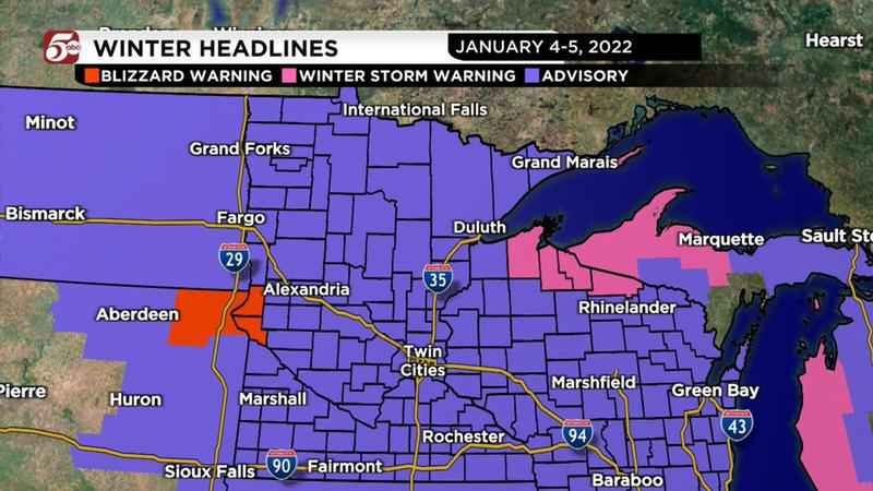
Advisories throughout the state as of Tuesday, Jan. 4, 2022.[KSTP-TV]
Track weather where you are via the KSTP weather page.
Find KSTP’s complete winter weather guide here.