Light snow, bitter cold to wrap up 2021
[anvplayer video=”5080933″ station=”998122″]
Bundle up for your New Year’s Eve and New Year’s Day plans.
Meteorologist Matt Serwe reports the end of 2021 will bring with it light snow and a significant cold snap.
Serwe says after dense fog early Friday, light snow is moving into the metro and is expected to last through the afternoon. Accumulation in the Twin Cities and north and west metro is expected to be around 1 to 3 inches, Serwe said, before temperatures drop into the single digits Friday evening before bitter cold sets in.
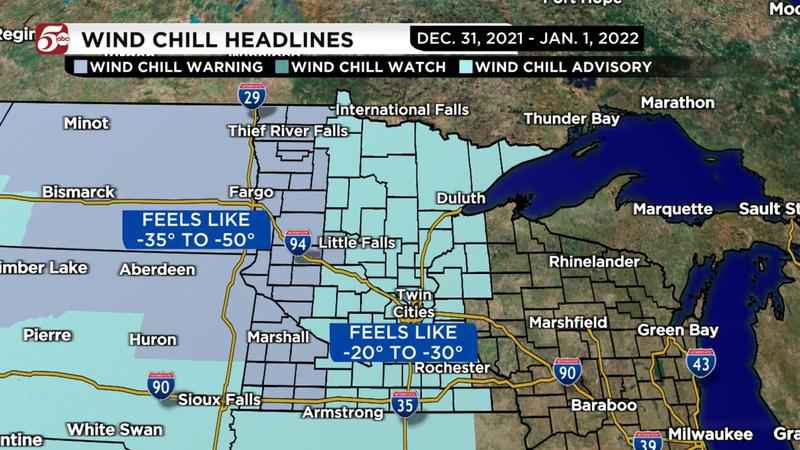
The National Weather Service (NWS) has issued a wind chill advisory from 6 p.m. Friday through noon Saturday. Serwe says wind chills in the Twin Cities are expected to range from minus 20 degrees to minus 30 degrees Friday through Saturday and into Sunday morning. The NWS advisory states in some areas, wind chills could drop as low as minus 40 to minus 45 degrees.
Due to the dangerous nature of those wind chills, Serwe advises dressing in warm layers from head to toe, making sure one of those layers is thickly insulated if venturing outside.
[KSTP-TV]
The NWS reports the coldest wind chill temperatures were expected along the border with Canada. The weather service says frostbite can occur in as little as 10 minutes when wind chills are 45 degrees below zero.
Track weather where you are via the KSTP weather page.
Find KSTP’s complete winter weather guide here.