Drought conditions remain mostly unchanged in Minnesota, exceptional drought reported along Wisconsin’s South Shore
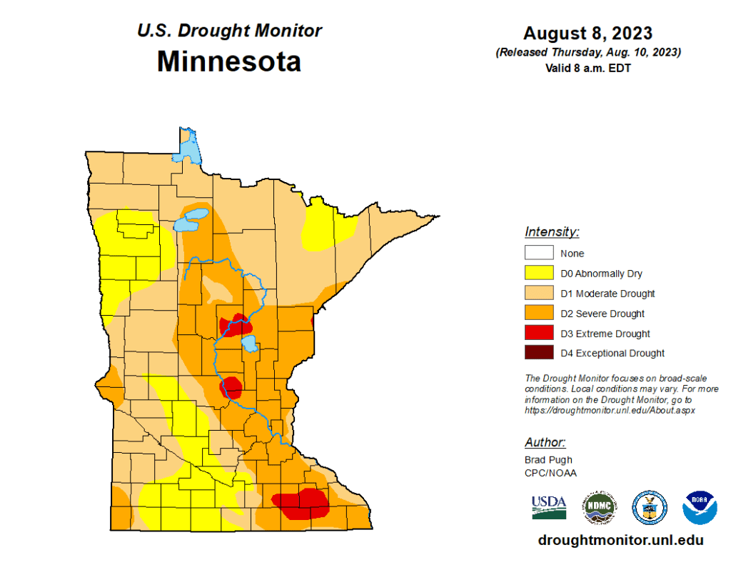
The latest data from the U.S. Drought Monitor shows the level of dry conditions have hardly changed since last week’s report in Minnesota, however, conditions have worsened across parts of Wisconsin.
According to Thursday’s report, areas in Minnesota experiencing extreme drought decreased by six-hundredths of a percent from last week to 2.83%, and moderate drought increased by seven-hundredths of a percent to 79.79%. Meanwhile, severe drought conditions increased from 33.62% to 33.99%.

Sweeping up after some yardwork outside her Uptown home, Evelyn Hill says this summer, she’s trying to be conservative in her outdoor water use.
“We’ve had droughts for the last couple of years, in my recollection,” she says. “It’s gotten where we’re only watering every other day and just spots that are really dry.”
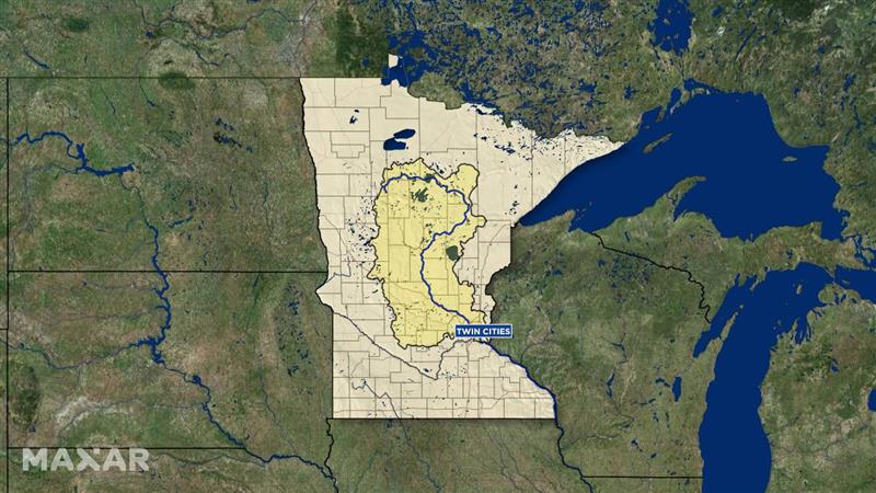
Hill’s approach comes as the Mississippi Headwaters Watershed — an enormous area that runs north from the metro, all the way to Bemidji — has entered a drought warning phase.

“Much of the Mississippi basin is anywhere from four to eight inches — in some areas higher than that —below normal, since about mid-May,” explains Luigi Romolo, a Minnesota State Climatologist with the Department of Natural Resources. ”Things are getting pretty serious because of the fact that we’ve had drought back-to-back.”
All of this is happening as Minneapolis residents are using about 70 million gallons of water a day — most of that is used for watering outdoors.
City water officials say that compares to about 54 million gallons used in the winter.
So now, they’re asking residents to voluntarily cut back on outdoor water use.
Among the ideas: watering during the coolest part of the day, watering grass only as needed, leaving grass clippings as shade for soil and turning off automatic water sprinklers.
“Different areas of the watershed may be moderate drought, severe drought, or extreme drought,” says Annika Bankston, the director of the Minneapolis Division of Water Treatment and Distribution Services. “Maybe just a little bit less lawn watering, really maintain that use. Don’t feel the need to increase water use, especially in your lawns and gardens.”
But what about all that flooding we had in late summer?
The DNR says that excess moisture was quickly absorbed into the ground.
“The ground can only hold so much water,” Romolo says. “You’re really only about four to six weeks away from what could be the worst drought you’ve ever seen.”
Experts say we’re not there yet.
The DNR says the chief culprits for the drought conditions are the hot weather we’ve been having and a lack of rain.
The city says there are no mandatory rules in place just yet — like requiring homes and businesses to limit watering to every other day.
Hill says this year, she’s trying to do her part, using a mix of fescue, clover, and creeping thyme to seed her lawn.
“So, you have a mix of grasses that are very drought tolerant, so they require very little water,” she notes. “They don’t grow as fast; I’m not mowing as often.”
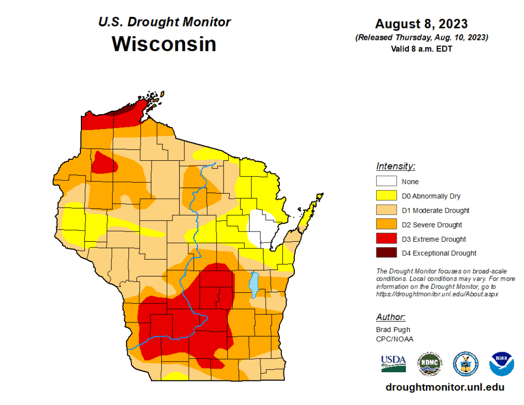
In Wisconsin, Pierce and St. Croix Counties are experiencing moderate drought or abnormally dry conditions, while the northern part of Polk County is listed as having a severe drought.
Much of the southwest part of the state is still under an extreme drought, as well as pockets of the northern part of the state, totaling 17.96%. Last week, that percentage was 12.15%. Severe drought conditions increased this week to 47.02%, while moderate drought increased to cover 82.18% of the state.
In addition, a sliver of land across Douglas and Bayfield Counties along the South Shore of Lake Superior is now listed under exceptional drought. The total percentage of land experiencing exceptional drought is 0.32%.

The latest forecast from Minnesota’s Weather Authority can be found by CLICKING HERE. Currently, there are chances for some isolated strong storms Thursday night, as well as some rain chances for Friday afternoon and evening, as well as late Sunday and into early Monday morning.
CLICK HERE for an interactive radar.